Trilha Sucupira
Description
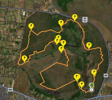
It is part of the Caminhos da Flona (4 trails for hikers, marked and self-guided, in the Brasília National Forest). It is important to highlight that the Flona is part of the Union Arc of the Central Plateau Paths, the District Ecological Trails System (Federal District). The marking of the Sucupira trail is a yellow footprint.
Guidelines Extension: 34.63 Km
 Difficulty Hard
 Orientation Easy
 Signaling Level Complete
 Conservation Excellent
 Risk Exposure Medium
 Sun Exposure High
 Hydration Point Unavailable
 Climbing No climbing required
 Minimum Altitude: 1150m Maximum Altitude: 1286m
 Negative Unevenness: 305m
 Positive Unevenness: 305m
Tips
Not provided in this language
Map
Guidelines
Extension: 34.63 KmDifficulty: HardOrientation: EasySignaling Level: CompleteMinimum Altitude: 1150m Maximum Altitude: 1286m Negative Unevenness: 305m Positive Unevenness: 305m 